Introduction
If rugged ridgelines, alpine lakes, and deep beech forests call your name, Romanian Carpathians hiking should be high on your list. This guide breaks down when to go, how to choose routes, where to stay, what to pack, and how to stay safe, whether you’re eyeing a weekend ridge walk or a multi-day traverse. Expect actionable tips, sample itineraries, real-world best practices, and expert insights to help you plan with confidence.
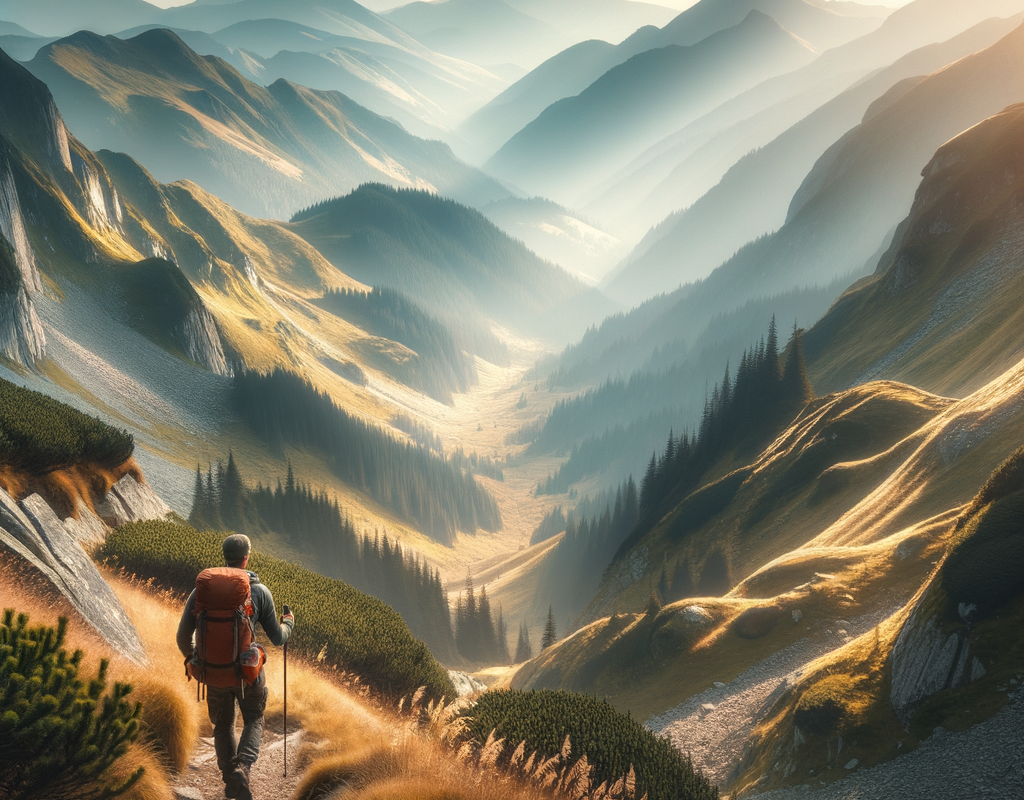
> The Carpathians are wild but welcoming—plan well, move early, and respect the mountains, and they’ll reward you with Europe’s most underrated hiking.
Choose Your Playground: Regions and Highlights
Southern Carpathians (Făgăraș, Bucegi, Piatra Craiului)
– Făgăraș: Home to Moldoveanu (2,544 m), Romania’s highest peak. Long, committing ridge days, scree, and weather exposure.
– Bucegi: Big plateau views with dramatic cliffs. Easier access from Sinaia/Brașov; weather can turn fast on the flat-topped massif.
– Piatra Craiului: A narrow limestone ridge famous for airy scrambles and sweeping views, with strict park rules on camping.
Western Carpathians (Retezat, Apuseni)
– Retezat: Glacier-carved lakes and rugged granite peaks. Classic hut-to-hut style hikes with varied terrain.
– Apuseni: Karst landscapes, caves, villages, and gentler forest trails. Great for shoulder season walks and cultural stops.
Eastern Carpathians (Ciucaș, Ceahlău, Rodna)
– Ciucaș: Sandstone towers and whimsical rock formations. Great day hikes and accessible weekend trips.
– Ceahlău: Moldavia’s sacred peak with panoramic sunrise views.
– Rodna: Long alpine ridgelines and wild valleys in the north, less crowds, bigger distances.
Quick Planning Tips by Region
– Short trip: Base in Brașov for Bucegi/Piatra Craiului day hikes.
– Classic multi-day: Făgăraș ridge section or Retezat hut-to-hut.
– Family-friendly: Apuseni and Ciucaș with moderate grades and clearer waymarking.
Best Time to Go and Mountain Conditions
Seasons at a Glance
– Summer (late June–September): Prime season. Snow patches can linger into July on high ridges. Afternoon storms are common.
– Shoulder seasons (May–June, late Sept–Oct): Quieter trails, volatile weather, lingering snow higher up; check conditions.
– Winter: Full alpine conditions above tree line. Specialized gear, avalanche awareness, and local guidance required.
Weather and Forecasting
– Expect rapid changes above 2,000 m; carry layers even in summer.
– Use the National Meteorological Administration forecast via reliable weather bulletins.
– Check Romanian mountain rescue (Salvamont) advisories before committing to ridges.
Trail Markings and Difficulty
– Trails use colored symbols (stripe, dot, triangle, cross) on white backgrounds; carry a map, don’t rely solely on one blaze.
– Typical day: 12–20 km with 800–1,400 m elevation gain on major ranges.
– Difficulty increases with exposure (Făgăraș, Piatra Craiului ridge). Plan conservative times.
Common Mistakes to Avoid
– Starting late and getting caught by afternoon storms.
– Underestimating exposure and committing to long ridges with few bailouts.
– Skipping a paper map and relying entirely on `GPS` without offline backup.
Romanian Carpathians hiking routes and itineraries
Classic Day Hikes
– Bucegi: Sinaia–Vf. Omu loop via Valea Dorului. 20 km, ~1,200 m gain. Plateau views; watch for fast-moving fog.
– Ciucaș: Muntele Roșu–Vf. Ciucaș circuit. 15 km, ~900 m gain. Iconic rock towers and flowers in late June.
Weekend Ridge Adventures
– Piatra Craiului North Ridge: Technical sections, fixed cables, long day; combine with overnight in a designated shelter or guesthouse in Zărnești.
– Retezat Lakes Circuit: Two-day loop linking Bucura and Zănoaga lakes, staying at Cabana Pietrele or tent zones.
Multi-Day Traverses (Case Studies)
– Case study: 5-day Făgăraș section. Approx. 60–70 km, 4,000+ m gain. Summits include Negoiu (2,535 m) and Moldoveanu. Water is seasonal; plan sources carefully. Bivouac shelters exist but fill fast in peak season.
– Case study: 3-day Rodna east–west. Broad alpine meadows, big days, fewer huts—carry a tent where permitted.
Navigation and Timing
– Download `GPX` tracks and carry a 1:50,000 map. Apps like Mapy.cz and Gaia GPS work well offline.
– Start by 7–8 a.m. in summer to avoid storms and allow buffers for route-finding.
How to Plan Like a Pro: Logistics, Permits, and Transport
Permits and Park Rules
– No general hiking permit required. National parks may charge small access fees.
– Camping: In parks like Piatra Craiului and Retezat, camping is restricted to designated zones; check park rules and maps.
– Drones: Often restricted in protected areas; verify current regulations.
Getting There and Around
– Trains: Use CFR Călători schedules to reach bases such as Brașov, Sinaia, or Zărnești.
– Local transport: Taxis and rideshares connect trailheads; some valleys have limited service—budget time for returns.
– Seasonal cable cars (Bucegi) can save ascent or descent time; wind closures are common.
Huts, Shelters, and Booking Strategy
– Huts (“cabane”) vary from rustic to comfortable; book weekends in advance (June–September).
– Alpine emergency shelters (“refugii”) are first-come, first-served; don’t plan them as guaranteed accommodation.
– Best practice: Mix huts with designated tent areas to keep daily distances flexible.
Packing and Food Strategy
– Carry a stove if camping; some huts serve hot meals, others only snacks.
– Water: Treat water from streams; ridges can be dry. Carry 2–3 liters in summer.
– For a complete gear list, see our packing list for mountain trekking.
Safety, Wildlife, and Mountain Ethics
Mountain Safety Essentials
– Tell someone your plan and expected return time.
– Carry a small first-aid kit, headlamp, and a backup power bank.
– In an emergency, dial 112 and contact Salvamont; precise location helps—use your `GPS` coordinates.
Bears and Wildlife
– Romania hosts one of Europe’s largest brown bear populations. Store food securely and never feed wildlife.
– Make noise in dense forests, hike in small groups at dawn/dusk, and give animals space.
– Read WWF Romania guidance on large carnivores for evidence-based tips.
Leave No Trace in the Carpathians
– Pack out all trash; micro-trash matters in windy alpine zones.
– Stay on marked trails to protect fragile vegetation and reduce erosion.
– Respect local shepherds and flocks; give guard dogs a wide berth and pass calmly.
Common Safety Pitfalls
– Overreaching on day 1 of a multi-day trek and carrying fatigue forward.
– Ignoring hail and thunder signs. If you hear thunder, descend from ridges.
– Not carrying a rain shell in “good” weather—storms build fast.
Gear and Skills: What Matters Most
Core 3-Season Kit
– Footwear: Waterproof, broken-in boots or robust trail shoes with grip.
– Layers: Wicking base, fleece or light puffy, waterproof shell; light gloves and hat.
– Navigation: Paper map + compass, offline maps, and a backup `GPX` route.
Add-ons That Pay Off
– Trekking poles for steep descents and scree.
– Lightweight microspikes early season if snow lingers on passes.
– Emergency bivy sack for peace of mind on long ridges.
Fitness and Skills Checklist
– Train with back-to-back 15–20 km days and 1,000 m gain to mimic Carpathian profiles.
– Practice moving on loose terrain and mild exposure before tackling ridges.
– Learn basic weather reading: cloud build-up, wind shifts, and storm timing.
Internal Resources for Planning
– Build your timeline and budget with our Romania travel planning checklist.
Putting It Together: Sample 4-Day Itinerary
Day-by-Day Overview (Bucegi + Piatra Craiului)
1) Day 1: Arrive Brașov; transfer to Zărnești; warm-up hike in Piatra Craiului foothills.
2) Day 2: Piatra Craiului ridge section to Curmătura area; stay at a hut/guesthouse.
3) Day 3: Transfer to Bucegi; cable car if running; hike to Vf. Omu via plateau trails; overnight at cabana.
4) Day 4: Descend via Caraiman; visit the sphinx formations; return to Brașov.
– Distances: 45–55 km total; elevation gain ~2,500–3,000 m.
– Variation: Swap in Ciucaș if weather closes the Bucegi plateau.
> Pro tip: Build one “weather flex” day into any multi-day plan. It turns stress into options.
Conclusion
Romania’s mountains reward thoughtful planning with outsized adventure. Choose the right region for your goals, build conservative days, and respect mountain weather, and you’ll thrive. For streamlined prep, lean on offline maps, hut bookings, and a smart packing list. If you’re ready to make Romanian Carpathians hiking a reality, sketch your dates, shortlist routes, and gather your gear this week—your perfect window may be just a forecast away. What ridge, lake, or peak do you want to stand on first?
FAQ
Q: Do I need permits to hike in Romanian national parks?
A: No general permit, but some parks charge small entry fees and restrict camping.
Q: What’s the best month for stable weather?
A: Late July through early September offers the most reliable conditions above tree line.
Q: Are huts open year-round?
A: Many operate mainly in summer; confirm shoulder-season schedules and book ahead.
Q: How can I avoid bears on the trail?
A: Hike in small groups, make noise in thick forest, store food well, and never feed wildlife.
Q: Is navigation difficult?
A: Trails are marked, but fog and snow complicate things—carry a map, compass, and offline `GPS`.


